The Global Positioning System looks like a map technology, but at its core it is a timing system. Every GPS satellite continuously broadcasts a radio message that says, in effect, "I am here, and this is exactly when I sent this." A receiver on the ground measures how long the message took to arrive and multiplies that delay by the speed of light. The result is a distance. Repeat that with several satellites and your location falls out of geometry.
The catch is the size of the numbers. Radio waves move at about 300,000 kilometers per second, so a timing error of one microsecond, a millionth of a second, becomes an error of about 300 meters. A single nanosecond, a billionth of a second, corresponds to roughly 30 centimeters. To place a phone or aircraft within a few meters, the entire system must agree about time to within tens of nanoseconds. That requirement drives almost every design decision in GPS.
How Timing Becomes Position
Imagine hearing thunder and knowing exactly how long after the lightning flash it arrived. You would know you are some distance from the strike, but not in which direction. A single satellite tells the receiver only that it lies somewhere on a huge imaginary sphere around that satellite. A second satellite produces another sphere, and the two intersect in a circle. A third narrows the possibilities to two points, one of which is usually absurd, far out in space or deep underground. This process of locating a point from distances to known points is called trilateration.
The satellites are the known points. They fly in medium Earth orbit at about 20,200 kilometers above the surface, arranged in six orbital planes, and each circles Earth twice a day. The constellation is maintained so that at least 24 satellites are operational nearly all the time, which ensures that a user almost anywhere can see at least four of them at once. NASA notes that the system delivers meter-level positioning and timing precision on the order of tens of nanoseconds worldwide, at any hour.
Why a Fourth Satellite
If receivers had atomic clocks, three satellites would be enough. They do not. A phone contains a small, inexpensive quartz oscillator that drifts by far more than a nanosecond over even a short time. So the receiver's own clock reading is unknown.
This turns the problem into four unknowns: latitude, longitude, altitude, and the receiver's clock error. Four measurements can solve four unknowns. The receiver finds the single clock correction that makes all four distance spheres meet at one point. In effect, each satellite lends the receiver its atomic precision, and the fourth signal is what gets that timing gift transferred. Any additional satellites in view improve the estimate and help detect bad measurements.
Why Atomic Clocks
The satellites themselves must be far more precise than the receivers, because their errors affect every user. So each carries atomic clocks, backed up by redundant units. An atomic clock regulates an oscillator using the natural resonance of atoms, which is identical for every atom of a given isotope everywhere in the universe. The international definition of the second is based on this: counting 9,192,631,770 cycles of microwave radiation absorbed and emitted by cesium atoms, as explained by the National Institute of Standards and Technology.
Quartz crystals and mechanical pendulums depend on manufacturing details, temperature, and age. Atoms do not. That reproducibility is what lets a satellite clock stay consistent enough for a receiver to trust. Ground control stations monitor the constellation, compare each satellite's clock to reference time, and upload small corrections that the satellites include in their broadcasts.
The Relativity Correction
Precise clocks reveal something odd: time does not flow at the same rate everywhere. Einstein's special relativity says a moving clock ticks more slowly. GPS satellites move at several kilometers per second, so their clocks lose about 7 microseconds per day compared with clocks on the ground. General relativity says that clocks run faster where gravity is weaker. At orbital altitude, gravity is weaker than at the surface, and satellite clocks gain about 45 microseconds per day.
The net result is that satellite clocks run about 38 microseconds per day faster than identical clocks on Earth. That sounds small, but 38 microseconds times the speed of light is more than 11 kilometers. Left uncorrected, position errors would accumulate at roughly 10 kilometers every day, and the system would be useless within minutes. Engineers account for this by adjusting the clock rate before launch and applying further corrections in the signal processing. NIST describes GPS as the longest-running practical test of Einstein's theories, a role it never was designed for.
Historical Context
The first NAVSTAR satellite was launched by the U.S. Department of Defense in 1978, building on earlier Doppler-based navigation methods developed in the era of Sputnik. The 24-satellite system reached full operational capability in 1993. It is owned by the U.S. government and operated by the Space Force, and civilians worldwide receive the signals freely. Other nations have built comparable systems, and modern receivers often combine several.
Everyday Examples
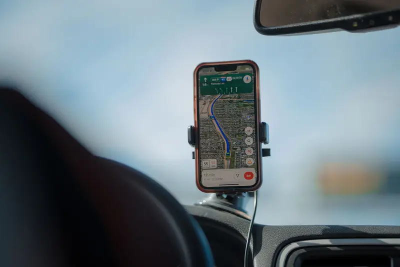
Navigation apps are the obvious use, but timing is the quieter contribution. Networks, financial systems, and power-grid monitoring equipment use the precise time transmitted by GPS to keep distant machines synchronized. Aircraft and ships use it for navigation, and surveyors combine signals to reach far greater precision than a phone provides. A phone on airplane mode can still receive GPS, since receiving a satellite signal involves no transmission; many phones simply leave that receiver available. And the same satellite-based approach to communication, treated more broadly, is explained in how satellites enable long-distance communication.
Robots and drones also rely on satellite positioning outdoors, often fused with other sensors, as discussed in how robots perceive their surroundings.
Limitations and Misconceptions
GPS satellites do not track you. The signal flows one way, from satellite to receiver, and the receiver does all the computing. A phone can also work out its position without sending anything anywhere.
Signals are extremely weak by the time they arrive, weaker than the background noise in the receiver, and they are recovered only by correlating with known codes. Buildings, tunnels, and dense urban canyons block or reflect the signals, and reflections make the measured travel time too long. Accuracy in a city can therefore be much worse than in an open field.
It is also incorrect to say that GPS gives altitude or position "from the sky" without clocks. Every part of the system depends on the same principle: timing measurements of a signal moving at a known speed.
In Short
GPS converts the travel time of radio signals into distance, and because light covers 30 centimeters in a nanosecond, timing precision is positioning precision. Atomic clocks in orbit supply the reference, a fourth satellite removes the receiver's clock error, and relativistic corrections keep the whole system from drifting by kilometers per day.